Nar Phu Annapurna Circuit – Day 14 of 15: Crossing Thorong La Pass to Muktinath
This is it. The day every trekker on the Annapurna Circuit has been turning over in their mind for weeks. We are a little different. We have crossed the Thorong La before, and we have already completed the Kang La Pass on the Nar Phu section on this trek. This final crossing is about revisiting and the road free Nar Phu Annapurna Circuit, a 13-15-day route linking Nar Phu, Kang La, with Tilicho Lake and the Thorong La that we have been building and testing since Day 1 in Koto. The name took a while to settle on. I’m still not sure! I must also confess that I let rip a little again on this post. I tried my best to make this Nar Phu Annapurna Circuit without my personal life thoughts coming in, but I guess on the second last day, it’s what happens. We’ll blame the altitude!
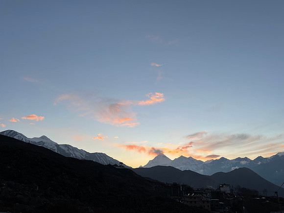
We were up at 4:00 AM. A light breakfast first, more food on the trail. Again if staying at High Camp there’s no urgent need to leave at 4am – 6am is fine and the pass is still well within reach. If someone stayed at Thorong Phedi Base Camp below then earlier is better. It can be a very long day depending on ones pace and conditions. I will come back to that later. As we stepped outside, a bone-chilling wind was cutting around the lodge walls and our head torches were doing their best against the dark. Surprisingly, the wind died within the first thirty minutes of trekking. The mountain giveth, finally.
The Ascent: False Summits and High-Altitude Tea
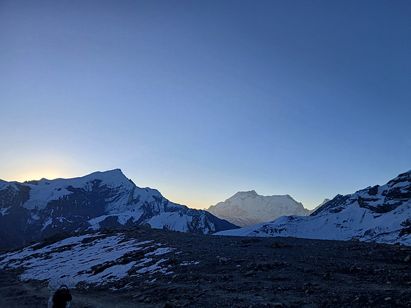
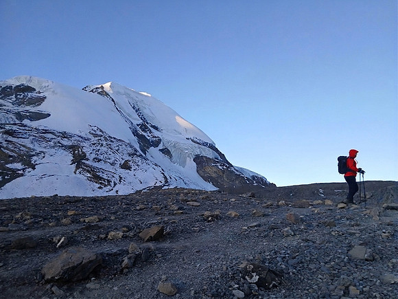
The trail from High Camp at 4,880m to the Thorong La at 5,416m is a long slow grind like any high pass worth crossing. We moved in a duo of head torches, boots sinking into dense frozen snow. Unlike the rocky slope of the Kang La, the snow here provided reasonable grip provided we followed the boot prints left by the previous day’s trekkers, which were still clearly visible.
For first-timers, this is often where mental fatigue becomes the real challenge. One will see a ridge decorated with prayer flags, push one’s way up to it on burning legs, and find a zig-zag trail continuing higher on behind it. Amazingly, this is not a cruel trick. High-altitude trails in Nepal are deliberately routed this way to lead trekkers and traders step by step rather than confronting them with the full vertical at once. They are literally there to mark the way not just for trekkers, but also trade during all seasons. We passed several of these ridges, each one a minor heartbreak for anyone already running on fumes. Again, the advice is this: take short steps. Stop. Do not look up and groan at the difficulty. Instead, stop, and look back. The views behind you as the sun hits the Annapurna peaks are among the best on the entire route, and they remind one of how far one has already come. It’s also a chance to blow a raspberry at anyone who says the Annapurna Circuit has no good views.
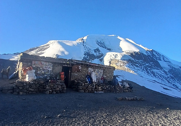
At around 5,400m, in peak season, a tea shop appears on the slope – one of the more surreal commercial enterprises on the planet, run by an enterprising local who carries everything up to nearly 5,500m to serve hot drinks to suffering trekkers at prices that are entirely justified. It was closed for us at this time, and it is every winter, monsoon, and through the off season. We used the shuttered building as a convenient excuse to stop and eat our packed meal regardless. There’s another at the top of the high pass too. I’ll stop here or I’ll go off on a rant about an impending first high altitude hotel on Throng La, or some tourist boards idea for a zip line down to Muktinath. Laugh now, but come back and read this in a decade.
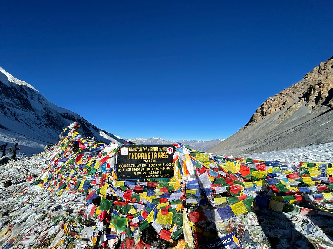
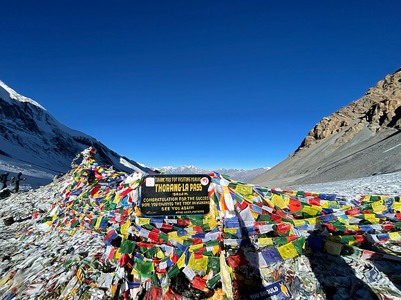
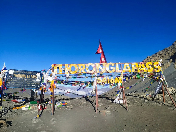
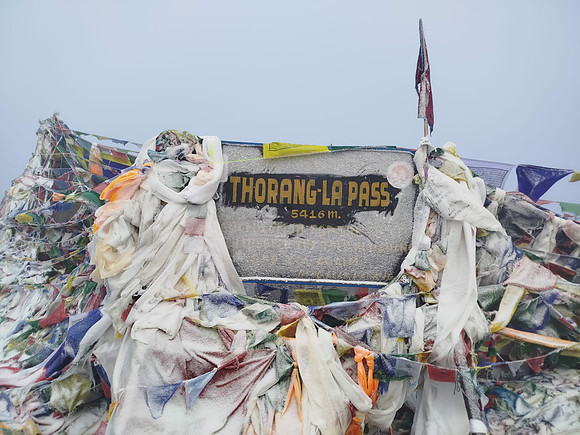
Like an old acquaintance we reached the metal sign marking our destination and altitude with a mass of prayer flags that mark the pass. It was about three hours up for us. Yes, others have done it faster, more have done it slower. At 5,416m, the panoramic spread is wonderful. Behind us the Annapurna peaks catch the morning light in gold and the brilliant snow white. Ahead, the landscape drops away into the vast, arid, purple-hued terrain of the Mustang region which is my favorite. Two completely different worlds, separated by a ridge of stone and a tangle of prayer flags.
The People You Meet at the Top of the World
We are the first to Thorong La today. Alone we stand. But there’s that new sign sticking out like a sore thumb. I’m not so happy about it, and haven’t been since it went up in 2023. A big metal yellow one next to the traditional metal one. Why? It looks circus like. They tried the same on the Everest Base Camp trek until “someone” tore it down. At any rate, in a few years some numbskull will build a zipline to Muktinath, I’m convinced of it. The crux of all this is I turned to avoid the new sign and memories came back from the past to calm my angst. Over many years of crossing the Thorong La, and through Gautam we recall the near exact foot marks up here where we met others.
We have met trekkers on horses and donkeys, too exhausted or too unwell to walk, being led across by their guides. We have met people on stretchers. There have been solo trekkers coming the opposite direction in conditions that made that decision look very questionable. We have met people whose phones had died mid-climb who asked us to photograph them and message the images later, which leads to the strange experience of swapping contact details at 5,000m. I always push for an email address over an Instagram handle. A photo sent to Instagram at that resolution will be compressed by the algorithm into something barely worth posting. Some people understand this immediately. Others are too tired to care, which is reasonable at 5,416m. There was a woman who spent the crossing looking for a place to take a tripod and find for the right angle for a handstand shot for her IG Stories. We let her get on with it as the tripod kept blowing over. There’s also an old Nepali belief that one should be respectful on a mountain. Doing a handstand or more certainly a handstand with splits is marked as a fail in terms of respect.
Then there are those who are disappointed. Yes, genuinely. I have met trekkers who reached the pass and found it underwhelming, who weren’t sure what all the fuss was about. Those who came at the wrong time of year with thick cloud and then became surprised that their “travel agent” didn’t tell them. I have no real explanation for this. Buy a guidebook for impartial advice, don’t take advice from a sales person or an unknown person on FB. The pass is what it is. Knowing what to expect and when, is really important to get the most out of a trek.
There were also those who have succumbed to illness and pushed on anyway, visibly unwell, vomiting near cairns at the high pass. Those who spent the entire ascent loudly explaining why they had skipped acclimatization days. Those who announced they had no need for a guide while following the footprints of someone else’s guide. Later they’d be spreading this online, and I hope through posts like this people will remember questions about what time of year they were trekking, what happens if they were sandwiched between days of no other trekkers, what the conditions were like – the very questions they had not asked themselves.
As always, those who boast loudest on a high pass are generally best given a wide berth.
One category I will mention because it needs to be said: I’ve also met those looking for a helicopter out. Not for medical emergencies, which are entirely legitimate, but for those who simply did not want to walk down to Muktinath and were attempting to engineer a “rescue” to claim on travel insurance. In my observations over many years, this is not a rare occurrence, and it is not always driven by a trekking company. The trekking rescue scam works in both directions. Anyone considering this should know that the majority of insurance companies operating in this region are well aware of the pattern. For what it’s worth, helicopters cannot land on Thorong La either.
To end on a high point or positive, there are those who make the whole thing worth witnessing up here. New couples who chose this as a test of what they were building together. Older couples doing the same, decades in. An old man, sitting down with a thud onto a stone beside the prayer flags, nodding slowly at the mountains with his guide beside him as if it would be his last time. These are the people who arrive at the top of the Thorong La. All on entirely separate journeys that happen to converge at the same point on the same high ridge over the years.
The Descent: 1,700 Metres of Concentration
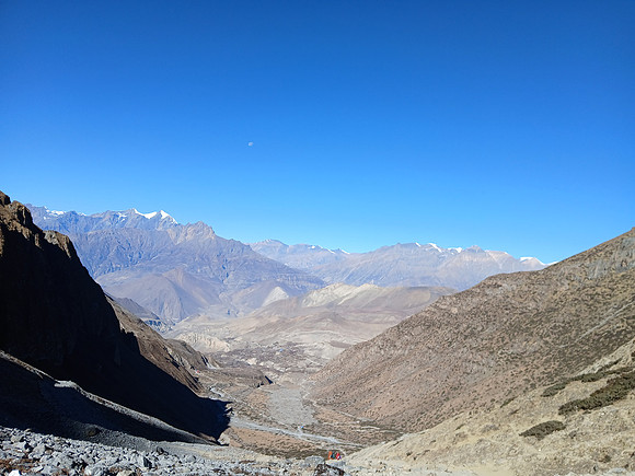
If the ascent tests ones lungs and quads, the descent to Muktinath tests ones knees. It is roughly 1,700 metres of steep drop over a relatively short horizontal distance, and it is steep throughout. Gautam descended like a mountain goat. I descended like someone who values their knees like thin glass and intends to use them on future treks. It is not a race and I am glad it is not.
The initial section from the pass is often covered in hard, slick ice, worse in winter and the off season. Trekking poles are so helpful. Some trekkers use micro-spikes here, which is a reasonable call depending on conditions. The wind through this section can be brutal, channeled by the terrain on both sides directly at whoever is trying to stay upright on an icy slope. Though today, it’s a mere breeze.
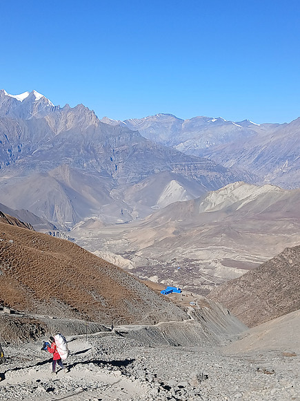
Once the snow and ice give way, the trail becomes a stretch of loose gravel and rocky steps. The steps are deliberate infrastructure – someone built them into this slope, and without them the injury rate on this descent would be considerably higher than it already is. The brown stones are hard, angular, and relentless. I took them one at a time. Gautam waited with the patience of someone who has done this many times and knows better than to say anything.
We were overtaken by trekkers who had left after us. That’s fine. We had just completed the Nar Phu Annapurna Circuit across 14 days, and that thought occupied most of the descent. Is the name right? Will it catch on? Is this something other trekkers will want to do now that the solo permit has changed the equation? I have no way to see the future. What I know is that we have linked the Nar Phu Valley with the Annapurna Circuit, crossed two high passes, visited medieval villages that most trekkers will never see, visited the highest lake in the world, and walked a route that is almost entirely free of the road damage that has plagued the lower circuit for fifteen years. Whether it becomes a thing or not, it works.
Arrival in Muktinath: A Cultural Collision
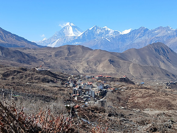
Reaching Muktinath, sitting between 3,710m and 3,800m depending on where in the village one ends up, is a genuinely surreal transition. After two weeks in quiet mountain settlements and restricted valleys, we walked into a bustling pilgrimage site with restaurants, bars, yak burgers, cheese momos, cold Coke, Mars bars, Snickers, and beer. For some trekkers, this is the welcome relief the body, or mind, has been asking for. For others, the shift from remote high-altitude trekking to full commercial activity in the space of a descent is jarring enough to need a moment to sit with.
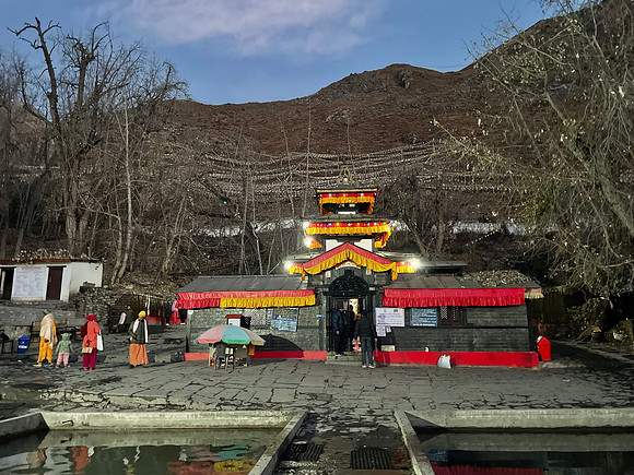
Muktinath is also a genuinely sacred place for both Hindus and Buddhists, which the commercial layer can obscure if you are not looking for it. Pilgrims in lightweight sarees having travelled from the heat of the Indian plains move through the same streets as salt-stained trekkers in Gore-Tex. It feels less like the end of a trek and more like a border crossing into a different country entirely. In a sense, it is.
Where to Next: Wrapping Up or Pushing On
From Muktinath there are direct buses to both Pokhara and Kathmandu, which makes this a clean finishing point for a 15-day Nar Phu Annapurna Circuit. If we had moved slightly faster through the Nar Phu section, this could be done comfortably in 14 days. 13 days if one skipped Tilicho Lake. For those completely new to trekking: yes, you count the days in a vehicle to reach the trek as being part of the trek. It’s just the way it is, otherwise, logistically, it throws the amount of time needed out. I remember one Dutch lady being adamant that the number of actual trekking days is what should be counted. So, I asked about how she’d get a guide with two less days or reach the trail head with no days counted? She seemed to think guides should be waiting at various villages on the way to take trekkers instead of driving up as well. No, it’s not 1970 anymore. Licensed guides are in the city, waiting for clients. Yes, in the mountains you’ll come across someone saying they are a guide, but you’ll be going down a bad road to hire them – they will be uninsured, they are likely not licensed or qualified, and they may be looking for at your travel insurance to scam some money. Do read about how to hire a trekking guide. I’d love it to be different, but that’s the reality. Again, I’m baffled how some people think things out instead of reading a guidebook about what it’s actually like.
For those looking to extend their trek, Upper Mustang is the obvious extension from here, and it is my favorite trek in Nepal. Solo trekkers can now access it with a guide, though the Upper Mustang permit remains USD $50 per day. For me, there is a specific part of eastern Upper Mustang I want to spend time in. But we came into this trek not knowing whether linking Nar Phu to the Annapurna Circuit would work at all. It does. That’s enough for this “edition”.
Tomorrow is Day 15, and I will wrap things up properly with alternatives, extensions, and an honest assessment of the Nar Phu Annapurna Circuit as a route that replaces the old Annapurna Circuit. Kagbeni is the answer I keep returning to as the most honest finishing point for trekkers who want one more night in a village that earns its place in any guidebook. But that is tomorrow.
Tonight, we sleep with more oxygen in the air than we have had in a week. The two high passes are behind us. The hidden valley is behind us. The route is proven. For full itinerary details, permit logistics, and everything needed to plan the Nar Phu Annapurna Circuit via my guide, or see my Trekking in Nepal guidebook.
Next: Day 15 – Muktinath and Beyond: The verdict on the Nar Phu Annapurna Circuit, alternatives, and extensions for those who want more.
Get the Only Guidebooks Worth Reading
Most guidebooks are years out of date or filled with paid placements. My books provide a complete strategy for Nepal with 100% independent reviews. Get the exact costs for every meal, bed, transport, plus the world’s only vetted, scam-free trekking agency list.
 Trekking in Nepal |
 Nepal Guidebook |
Sounds like a great trek over all, impressed.
Thanks, glad you enjoyed.
So my big question – was Throng La easier than Kang La or the other way round?
Hmmm, I’d say Thorong La is a little easier, but it may just be because of the acclimatization!
Good to read your experience on the pass after Nar Phu. Looks like successful trek!
It was a successful trek!
The winter and peak photos of Thorong la really show the difference. I can’t believe people don’t research any more.
AI, ChatGpt etc. People type into their phones, get an answer, done. Unfortunately they lose out because AI mainly scans the trekking agents selling treks so the data is tremendously skewed.
Coming back here after reading the other days. I think that you are correct that this trek can replace the old Annapurna Circuit route. It looks even better in may regards with the two high passes.
Yes, I would agree. It’s a better trek in terms of culture and indeed trekking as both take on a lot more than the original Annapurna circuit.
Congratulations, I enjoyed reading throughout your trek. That last pass is looked great.
Thank you. The Thorong La is one of my favorites. Turn around and see the Himalayas is the key rather than plodding on.
Well done. Great stories in there about the people who came before!
Glad you enjoyed them. They were nice to write up as well.
I think that I know the answer already. But the Nar Phu Annapurna Circuit or Manaslu? Which one would you say is better?
Nar Phu Annapurna Circuit. Done and dusted. Manaslu is great, but it’s nowhere near the same.